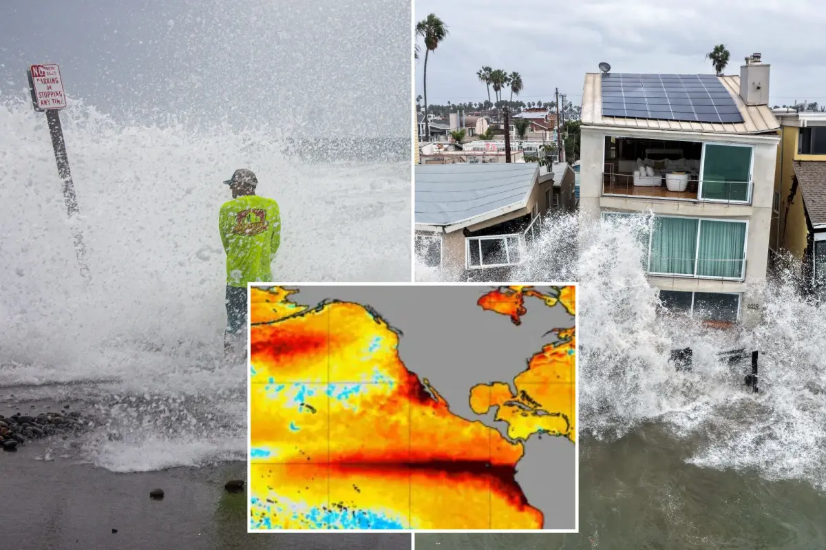

California’s looming El Niño threat is already taking shape. As the coast absorbs repeated blows, meteorologists warn that the massive Pacific weather pattern is showing an unusual “mutant” structure.
The potentially historic event has developed a “second arm” as Pacific Ocean temperatures surge. That configuration could raise the odds of powerful winter storms, flooding and destructive surf in the months ahead.
New images from Senamhi, Peru’s national meteorological and hydrological service, show a second band of unusually warm water extending from the coast of South America.
By several measures, the developing El Niño is already among the strongest on record. Climate scientist Daniel Swain warned in an Oct. 12 analysis for Weather West that the event could strengthen further as winter approaches.
Along Southern California’s coast, some of those warning signs are already becoming visible.
In Long Beach, city leaders on Friday presented a recovery plan after powerful surf from Tropical Storm Rachel damaged homes and infrastructure on the Peninsula. Seven homes remain red-tagged, down from eight, while officials continue assessing how many may need to be demolished.
With king tides forecast around Thanksgiving and a strong El Niño pattern developing, officials are working to reinforce the damaged coastline before another round of dangerous surf arrives.
“We’re now shifting into preparing for the next storm while we recover from the impacts of Rachel,” Mayor Rex Richardson said.
DON’T MISS: Trump Stands by Tariffs Despite Growing US Voter Opposition Ahead of Midterms
The developing El Niño and powerful oceanic Kelvin waves are adding to the coastal threat. Those waves can temporarily raise sea levels by as much as 12 inches, worsening flood risks when high tides and powerful surf strike vulnerable communities.
“I think that this year’s El Niño event is likely to be the strongest in 1,000 years if the latest models of its peak prove accurate,” climate scientist Zeke Hausfather told The Daily Mail.
California Gov. Gavin Newsom declared a statewide emergency last month as officials prepared for what could become the strongest El Niño event on record.
“The emerging El Niño event is already breaking records, and forecasters expect it to continue to strengthen, potentially becoming the strongest in recorded history,” Newsom’s office said.
The emergency declaration does not guarantee that California will be hit by severe storms. However, stronger El Niño events increase the likelihood of conditions commonly linked to the pattern, including heavy rain, flooding, powerful waves and coastal erosion.
California officials have said advance planning could help reduce some of the effects of the powerful weather system.
“We are not waiting for this season’s storms to be on our doorstep,” California Office of Emergency Services Director Caroline Thomas Jacobs said.
“By planning early and coordinating resources ahead of El Niño, we are working to ensure communities and first responders have the personnel, equipment, and support they need to prepare for severe weather, respond quickly when conditions change, and protect lives and property across California.”