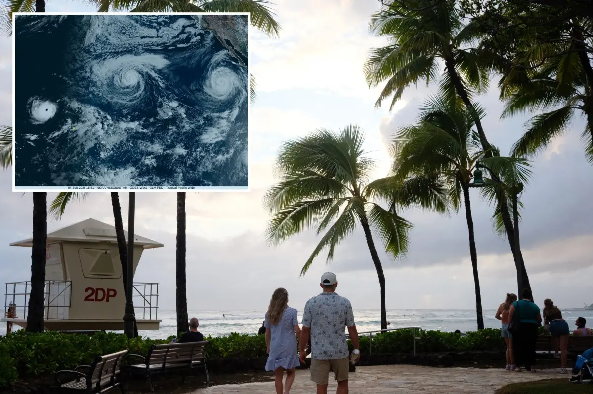

Hurricane Lowell has intensified into a powerful Category 4 system as it pushes across the Pacific Ocean.
Forecasters expect the storm to make a sharp northward turn on Sunday, a shift that could bring damaging winds, hazardous surf and flooding threats to the western Hawaiian Islands.
Computer models continue to show Lowell curving north, though they differ on just how close the hurricane may come to Hawaii, according to the San Francisco Chronicle.
The most recent forecast track has nudged Lowell slightly farther west, keeping the storm’s center offshore and to the west of Kauai.
If that westward trend holds, Kauai and the rest of the Hawaiian island chain could be spared the storm’s most severe impacts.
Updated forecast data now factors in regular readings from aircraft reconnaissance missions and drone observations, giving meteorologists a clearer picture of Lowell’s strength and path.
Lowell is expected to make its closest approach to the islands on Monday.
The National Hurricane Center said hurricane or tropical storm watches will likely be issued for parts of Hawaii on Saturday.
According to the current forecast, Lowell is expected to produce 3 to 6 inches of rain on Kauai and the Big Island, with isolated totals surpassing 10 inches.
Maui could get 2 to 4 inches of rain, with totals reaching up to 8 inches.
All of the rain could lead to flash flooding and mudslides, particularly in mountainous areas.
Lowell is the eighth hurricane there’s knowledge of to have reached a Category 5 storm in the central Pacific, and first since Hurricane Walaka in 2018.
The storm went from a 70 mph tropical storm to a 160 mph Category 5 hurricane in 36 hours, which is one of the quickest periods of intensification recorded, before being downgraded.
It could reach Category 5 status again.
Meantime, Hurricane Karina weakened to a storm with winds of 90 mph Friday morning, and will likely fall below hurricane strength on Saturday.
Hurricane Marie got slightly stronger Friday morning with winds reaching speeds of up to 100 mph, well off shore of Baja California, but it’s expected to get weaker Saturday.
Marie is expected to continue to move away from land, but could likely produce dangerous surf and rip currents throughout Labor Day weekend on the California coast.
Governor Josh Green of Hawaii has signed an emergency proclamation for the state to support preparation efforts and the potential aftermath of the storms.
“This proclamation gives our agencies and counties the flexibility to move people, equipment and resources quickly so we can protect communities across every island,” Green said. ” We encourage everyone to remain prepared and continue following official weather updates.”