A soaking stretch of severe weather is set to bear down on the Midwest.
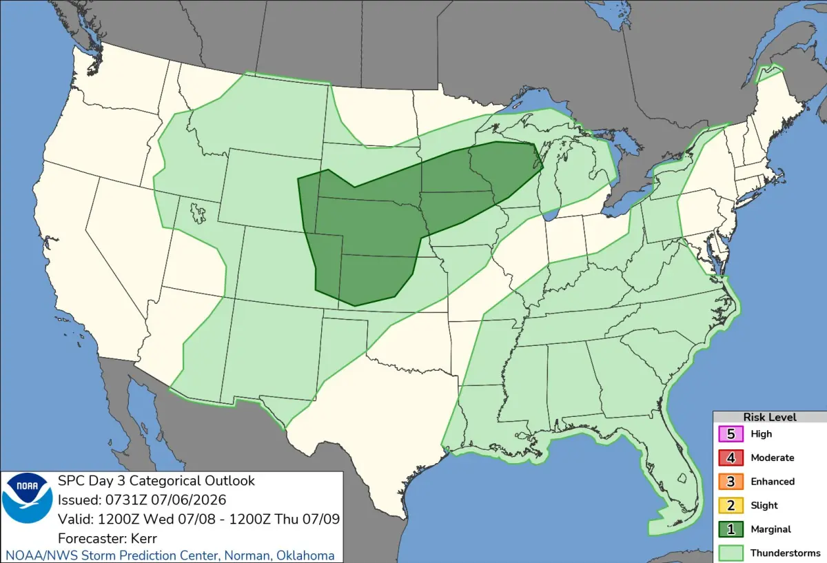
The National Weather Service says a powerful storm system could lash eight states on Wednesday — though the forecast map has drawn online attention for a very different reason.
The unusually shaped outlook shows a zone of thunderstorms, hail and damaging winds developing across the Upper Midwest before extending into the central Great Plains.
Forecasters expect the system to begin in Minnesota and track eastward through Wisconsin.
The heaviest activity is projected to expand across southern Minnesota and Iowa, where strong winds and hail could impact communities in its path, according to the forecast.
MORE STORY: Jared Fogle's Surprising Prison Life: How the Former Subway Spokesman is Spending His Time Behind Bars
“Clusters of strong thunderstorms with potential to produce severe hail and wind may evolve across parts of the Upper Midwest into central Great Plains Wednesday through Wednesday night,” the NWS said.
“In the low levels, a front should stretch from near Lake Superior into central NE, where it will stall.”
About 11.7 million people are currently included in the warning area.

Farther west, size of the warning area increases in size as it enters the High Plains.
The good news is that the risk of severe weather remains small — and could shrink later in the week.