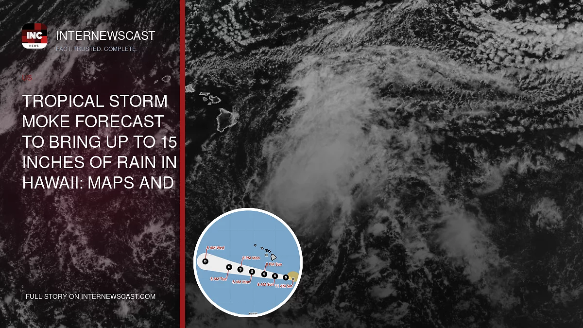

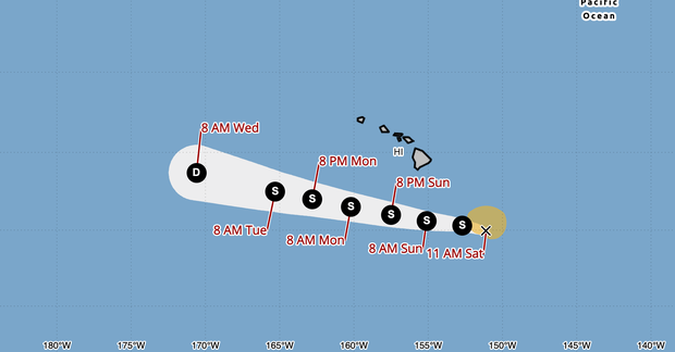
Tropical Storm Moke is forecast to bring bouts of heavy rain and blustery winds to Hawaii this weekend as it tracks just south of the island chain, arriving close behind the widespread damage caused by Hurricane Lala.
As of midday Saturday, Moke was carrying maximum sustained winds of 50 mph and was expected to gain strength through the day, the National Hurricane Center said. While forecasters do not expect the storm to come ashore in Hawaii, its outer bands are still likely to spread rain and wind across the Big Island late Saturday into early Sunday before conditions reach the remaining islands early next week.
“Recent impacts from Tropical Storm Lala mean that even light to moderate rain and wind could trigger flooding, debris, downed trees, roadway issues and power outages,” Maui County Mayor Richard Bissen said in a statement. “County departments have been preparing for Tropical Storm Moke, and we’re asking our community to do the same.”
NOAA
“This rainfall may produce life-threatening flooding and mudslides for the windward and southeast Big Island, especially in steep terrain and over areas that were affected recently by Lala,” according to the National Hurricane Center.
The renewed threat comes after Hurricane Lala battered the islands, with the Big Island taking some of the worst impacts just last weekend. Hawaii has not had a hurricane make a direct landfall since Iniki in 1992, but Lala, then a Category 1 storm, passed with its eye only about 30 miles off the Big Island coast. The close brush unleashed gusts topping 80 mph and soaking rainfall, with some communities recording more than 3 feet. Kapalua in Maui County saw 48 inches of rain over the weekend.
“We know many in our community are experiencing storm fatigue and still recovering from last weekend’s weather system, so mahalo for continuing to look out for one another and staying prepared — especially because we are up against an above-average hurricane season,” Bissen said.
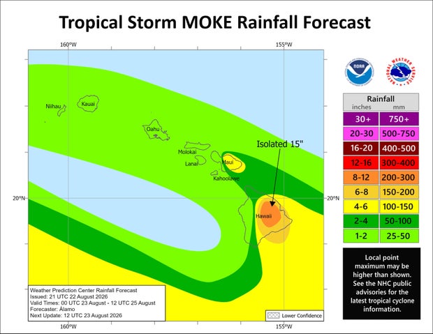
Moke is not expected to produce rainfall totals as extreme as Lala, but forecasters warn the storm could still create dangerous conditions because the ground is already saturated. The National Hurricane Center projects 5 to 10 inches of rain across the heavily affected Big Island, with isolated areas potentially receiving up to 15 inches. Eastern Maui could see a general 3 to 6 inches, while the rest of the Hawaiian Islands may pick up 1 to 2 inches.
NOAA
State officials in Hawaii activated the joint information center on Saturday, only days after shutting down the center used during Lala. The center helps the Hawaii Emergency Management Agency coordinate and distribute public updates during severe weather and emergency situations.
The islands are paying a price from an El Niño climate pattern, via warming waters in the eastern Pacific Ocean. Warm ocean waters are the essential fuel for tropical cyclone development, which makes this El Niño phase perfect conditions for an increased hurricane season in the region.
Because it reduces vertical wind shear, meaning change in direction of winds at higher levels of the atmosphere, an El Niño climate pattern allows for tropical systems that develop in the region to avoid getting “blown over” and falling apart.
Jonathan Vigliotti and
Nikki Nolan
contributed to this report.