
SAVANNAH, Ga. () — Light rain will come to an end overnight as the coastal low finally pulls away.
Periods of light rain and drizzle swept through the Coastal Empire and Lowcountry, causing damp weather. The rainfall was kept at manageable levels, avoiding any significant flooding issues in the region. The most intense rainfall occurred around Myrtle Beach as a low-pressure system moved ashore there.
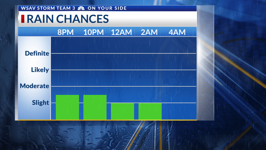
This low-pressure system will move northward, taking the rain with it and reducing the chance of showers after midnight. While clouds will linger, expect sunshine to emerge by Monday, with partly cloudy skies eventually giving way to more sun in the afternoon. Dry northwesterly winds will help usher in a pleasant week ahead.


Morning temperatures for the first half of the week will hover in the 50s to low 60s, while afternoons will be mostly sunny, reaching the upper 70s to low 80s. A cold front is set to arrive midweek, slightly cooling temperatures. High pressure will settle in post-front, ensuring continued sunshine and easing winds. This will lead to even cooler mornings, with some inland areas potentially dipping into the 40s.


Tracking the Tropics
In the Tropical Atlantic, there’s an area of interest located west-southwest of the Cabo Verde Islands. There’s a 50% chance it could become a tropical depression or named storm in the coming days, before being hindered by wind shear and dry air in the Central Atlantic. Currently, there are no tropical threats to the Coastal Empire and Lowcountry.


