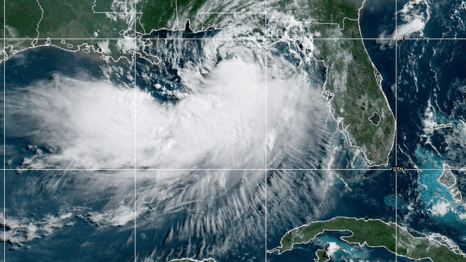

Gulf Coast communities were preparing for Tropical Storm Bertha on Wednesday, handing out sandbags and shutting down beach access as the system threatened to bring flooding rains and gusty winds from the Florida Panhandle to Louisiana.
Forecasters expected Bertha to come ashore Wednesday night in a sparsely populated stretch of coastal Louisiana southeast of New Orleans. Michael Buchanan, a National Weather Service meteorologist in Louisiana, said wind appeared to be the storm’s primary threat.
As of early Wednesday, Bertha was located about 145 miles (235 kilometers) west-southwest of Panama City, Florida, and roughly 75 miles (120 kilometers) east of the mouth of the Mississippi River, according to the Miami-based National Hurricane Center. The storm was moving west at 6 mph (9 kph) and had maximum sustained winds of 50 mph (85 kph).
A tropical storm warning covered areas from the Bay-Gulf county line in Florida westward to Morgan City, Louisiana. The warning also included metropolitan New Orleans and Lake Pontchartrain, the hurricane center said.
Forecasters warned that storm surge could reach up to 4 feet (1.2 meters) in Louisiana from the mouth of the Mississippi River to the Alabama-Mississippi state line. Lower surge levels were possible along parts of the Florida and Alabama coasts.
Rainfall totals of 2 to 4 inches (5 to 10 centimeters) were possible from western Florida to the southern Louisiana coast, with locally higher amounts in some areas. Forecasters said those heavier pockets of rain could trigger flash flooding, particularly in urban locations.
Bertha was projected to lose strength as it moved inland toward Texas, forecasters said.
Sandbag distribution sites set up
Officials in Mississippi, Louisiana and Florida opened sandbag distribution sites for residents, while red flag warnings were posted on some beaches to alert swimmers to dangerous rip currents. Along portions of the coast, double red flags indicated that Gulf waters were closed to swimming.
Beaches near Pensacola, Florida, were mostly deserted except for tourists taking photos of the pounding surf.
“For locals, this is just another storm,” said Candice Henderson, manager of the Crab Trap, a beachside restaurant that was packed Tuesday on Pensacola’s Perdido Key. “When you’re on vacation and it’s raining, you either shop or you go out to eat.”
Bertha is the second tropical storm of Atlantic season
Bertha is the second tropical storm of the Atlantic hurricane season. Tropical Storm Arthur in June brought heavy rainfall to the southeastern U.S.
Bertha could dump heavy rain on coastal areas of Mississippi that are still recovering from flooding brought by Arthur that destroyed and damaged homes.
“Because of that, people are definitely paying attention, or at least you would hope so,” said Jeff Clark, a spokesperson for Mississippi’s Harrison County, where six sites were open for sandbag distribution.
There had not been a need by Tuesday to open shelters or order evacuations, Clark said.
The National Oceanic and Atmospheric Administration expects a below-average Atlantic hurricane season this year, although that doesn’t eliminate the chances of a catastrophic storm.
Hurricane Fausto in the Pacific is far from land
In the eastern Pacific Ocean, Hurricane Fausto churned far from land Tuesday. The hurricane was about 805 miles (1,295 kilometers) west-southwest of the southern tip of Baja California moving west-northwest at 9 mph (15 kph) with maximum sustained winds of 80 mph (130 kph).
It was forecast to gradually strengthen and the hurricane center warned that ocean swells generated by Fausto could cause life-threatening surf and rip tide conditions on the Baja California coast.
Copyright © 2026 by The Associated Press. All Rights Reserved.