

Morning Tee times are preferred.
ORLANDO, Fla. – Scattered showers and thunderstorms moved through Central Florida on Saturday afternoon, bringing a stormy stretch to parts of the region. A few isolated storms may linger into the early evening, but the activity is expected to wind down by around 9 p.m., giving way to a very humid and mostly dry Saturday night.
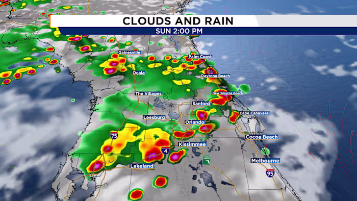
Father’s Day will start with plenty of sunshine, along with muggy conditions already in place by the morning hours. By late morning, around 11 a.m., spotty storms are expected to begin developing near I-75 before tracking east on a westerly flow.
Those storms should reach the I-4 corridor around midday and may linger into the early afternoon. By mid-afternoon and into the evening, the greatest storm chances will shift toward the coast. Afternoon highs will climb into the low to mid-90s, with heat index values making it feel closer to 100º to 105ºF.
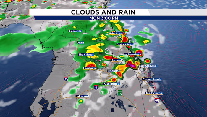
Looking ahead, rain chances are expected to drop as temperatures rise quickly. Strengthening upper-level ridging over Florida will help push highs into the mid to upper 90s, while heat index values could reach 105º to 108ºF. Heat advisories may be needed across much of the area next week, with rain chances limited to spotty or scattered coverage at best.