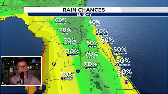


ORLANDO, Fla. – Central Florida’s wet weather setup is not letting go just yet. An unsettled pattern over the state will keep rain chances elevated, while the sea breeze gets an added boost to spark widespread, soaking thunderstorms Sunday afternoon.
Tonight
Scattered thunderstorms will keep drifting slowly west into the evening hours. Showers may hang around through about 9-10 p.m., with most areas turning drier closer to 11 p.m. or midnight. Overnight, the majority of Central Florida should stay quiet, though a few spotty coastal showers may develop as an east-southeast breeze pushes in from the Atlantic. Temperatures will settle into the mid-70s.
Sunday
A stalled front north of Florida, combined with a mid-level low spinning over the Gulf, will leave plenty of moisture and instability in place to fuel another active afternoon sea breeze. Sunday will begin mostly dry with intervals of sunshine and clouds, along with a few isolated showers near the east coast. By around lunchtime, showers and storms should begin developing near the I-95 corridor before becoming stronger and more widespread across Central Florida during the mid-afternoon. Some storms could produce wind gusts up to 50 mph, frequent lightning and pockets of localized flooding. The activity should gradually wind down after 8 p.m., with drier weather returning between 10 and 11 p.m. Afternoon highs will reach the upper 80s to low 90s before storms move through.
Next Week
The same muggy, unstable weather pattern will linger over Florida into next week, keeping the sea breeze active and rain chances above average for several afternoons. The wettest stretch is expected through midweek, with rain chances slowly easing back toward a more typical summer pattern late in the week and into next weekend. High temperatures will climb into the low 90s each afternoon.


